Olin. You got me to chuckle.
And you are right. Two inches can be a big deal in certain circumstances. Just cause something is there doesn't make it nirvana.
Tags make a difference and even though a lot of survey corners were set without the benefit of a tag, they should have been tagged.
Don't know when the mandatory tagging of monuments came into play, but I bet it was a long, long, long time ago. Maybe even before I was born.
Most lead and tacks don't come with a history on who ordered the survey and which land owners agreed that this was the corner. Did you see that written in the adjacent concrete anywhere?
One of the he best things a surveyor could do is to ask the adjoiner if they have any maps in their possession that would indicate a previous survey. That way you can't get blind sided like Paul said could happen, and he does have a good point.
Chain!
-
bruce hall
- Posts: 646
- Joined: Sun Oct 05, 2003 9:18 pm
- Location: huntington beach, orange county, california
That's pretty goood,
Bruce Hall Land Surveyor No. 4743
5732 Middlecoff Drive
Huntington Beach, Ca. 92649
714 840 4380
5732 Middlecoff Drive
Huntington Beach, Ca. 92649
714 840 4380
-
David Kendall

- Posts: 689
- Joined: Thu Apr 10, 2014 1:45 pm
- Location: Ferndale
I don't expect that an engineer would typically be concerned with a measurement less than a foot on a property boundary. If for some reason they were though, I reckon that a civil engineer would have one of those short handled four pound hammers to "correct" a discrepancy like 0.15' on the spot. Fence builders typically only have the 24 oz hammers which may not be sufficient to assert a similar solution. However, I wouldn't bet on the engineer being able to locate the corner monument in the first place...
-
dedkad
- Posts: 437
- Joined: Tue Jan 14, 2014 3:55 pm
Don't forget all the 12 oz "hammers" that the surveyors used at lunchtime that caused these problems to begin with.David Kendall wrote:I don't expect that an engineer would typically be concerned with a measurement less than a foot on a property boundary. If for some reason they were though, I reckon that a civil engineer would have one of those short handled four pound hammers to "correct" a discrepancy like 0.15' on the spot. Fence builders typically only have the 24 oz hammers which may not be sufficient to assert a similar solution. However, I wouldn't bet on the engineer being able to locate the corner monument in the first place...
-
LS 4722
- Posts: 479
- Joined: Wed Aug 15, 2007 8:42 am
Bruce
I think I would ask the adjoiner if they knew where their front property corner was.bruce hall wrote: One of the he best things a surveyor could do is to ask the adjoiner if they have any maps in their possession that would indicate a previous survey. That way you can't get blind sided like Paul said could happen, and he does have a good point.
If they point out the pipe, well, seems like a closed case to me.
You would be surprised how many owners know what marks their boundary.
Off topic a bit
My mentors, for the most part, just sucked. It took me years to shake all of their crap out of me so I could really make sensible and solid decisions on surveying.
Back in the early 70's there was a huge flood of work in regards to new condos and conversions. These were 1 lot subdivisions as most of you know and what one mentoring company would do was get the city field notes, run the block using the notes, and then cut the tract map on the top of a drafting desk.
This was the modus operandi of most of the companies in the LA area. After a while the city started doing "Tract Investigation" surveys, but from what I know nothing came from it.
It's pretty easy to change a field note C/L angle a few seconds and a couple of distances a few hundredths to mask that the condo tract map was just a paper survey.
-
Dave Karoly, PLS

- Posts: 670
- Joined: Fri Aug 30, 2002 6:26 pm
- Location: Sacramento
-
Olin Edmundson
- Posts: 229
- Joined: Sun Nov 09, 2014 8:37 am
-
dewardkb
- Posts: 94
- Joined: Sat Sep 01, 2007 7:00 am
- Location: Houston, Texas
- Contact:
https://www.facebook.com/photo.php?fbid ... d48753ef4f
https://www.facebook.com/photo.php?fbid ... 7be109e346
https://www.facebook.com/photo.php?fbid ... 1a46a14dce
Skelton, Boundaries and Adjacent Properties
Page 349
II. ESTABLISHED LINES DISTINGUISHED FROM MARKED LINES OF ORIGINAL SURVEY.
Lines fixed by establishment are to be differentiated from those which are proved to be marked lines of the original survey, the former are local in their effect and are not to be used as a basis of a survey in direct conflict with the deed calls, while the latter are the very best foundation for the reconstruction of the original plat. Rowland v. Campbell, 224 Ky. 1, 5 S.W. (2d) 278.
Page 369
VIII. BY PRIVATE SURVEY
"In absence of an expressed agreement that the survey is to establish the boundary, the fact the parties consent to a survey does not of itself establish the line as run by it (Stone v. Richardson, Iowa, 218 N. W. 332.)...."
Survey the way the local case law and law regulating Land Surveyors tells you to survey and not the way some internet/trade magazine hot air artist tells you to survey.
https://www.facebook.com/photo.php?fbid ... 7be109e346
https://www.facebook.com/photo.php?fbid ... 1a46a14dce
Skelton, Boundaries and Adjacent Properties
Page 349
II. ESTABLISHED LINES DISTINGUISHED FROM MARKED LINES OF ORIGINAL SURVEY.
Lines fixed by establishment are to be differentiated from those which are proved to be marked lines of the original survey, the former are local in their effect and are not to be used as a basis of a survey in direct conflict with the deed calls, while the latter are the very best foundation for the reconstruction of the original plat. Rowland v. Campbell, 224 Ky. 1, 5 S.W. (2d) 278.
Page 369
VIII. BY PRIVATE SURVEY
"In absence of an expressed agreement that the survey is to establish the boundary, the fact the parties consent to a survey does not of itself establish the line as run by it (Stone v. Richardson, Iowa, 218 N. W. 332.)...."
Survey the way the local case law and law regulating Land Surveyors tells you to survey and not the way some internet/trade magazine hot air artist tells you to survey.
I call them like I see them.
-
LS 4722
- Posts: 479
- Joined: Wed Aug 15, 2007 8:42 am
Olin
You had a very good teacher who understood that and passed it on....I've been taught that you should assume that earlier surveyors had better/more evidence than you currently have today just due to the fact that they were working closer to the time of original creation of the parcel, and that monuments tend to get lost/deteriorate over time. So this is all the more reason that you should think hard before calling things off.
-
dewardkb
- Posts: 94
- Joined: Sat Sep 01, 2007 7:00 am
- Location: Houston, Texas
- Contact:
http://img.photobucket.com/albums/v228/ ... 000587.jpg
http://vidmg.photobucket.com/albums/v22 ... e_Tree.mp4
Perfect reason not to go look for the original boundary in the first place.
http://vidmg.photobucket.com/albums/v22 ... e_Tree.mp4
Perfect reason not to go look for the original boundary in the first place.
I call them like I see them.
-
LS 4722
- Posts: 479
- Joined: Wed Aug 15, 2007 8:42 am
Keith
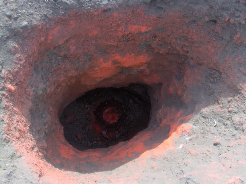
The 2nd link is a video that plays showing Deward digging the hole for the pipe in the ground. It appeared real small on my 2nd monitor so I maxed it, turned up the sound and had some popcorn.Must be a reason to see the hole in the street?
I am going to Home Depot tomorrow and will buy something called a shovel. Maybe I should try digging for monuments like the video shows.
-
LS_8750

- Posts: 1173
- Joined: Tue Jul 20, 2010 5:36 pm
- Location: Sonoma
- Contact:
Mr. Dewardkb, that has to be the most ridiculous and embarrassing piece of marketing I've seen from a land surveyor. Shame. You make us all look like clowns.
Seriously your silly rant about chaining and *****ing about magazine pundits is nothing new. You don't offer anything.
If you want to learn something, ask away. If you want to *****, write Dear Abby. Otherwise go back to Texas, and your big hat no cattle mentality.
Seriously your silly rant about chaining and *****ing about magazine pundits is nothing new. You don't offer anything.
If you want to learn something, ask away. If you want to *****, write Dear Abby. Otherwise go back to Texas, and your big hat no cattle mentality.
Clark E. Stoner, PE, PLS
Bear Flag Engineering, Inc.
Sonoma County
Santa Cruz County
tel. 707.996.8449 (Sonoma) or 831.477.9215 (Santa Cruz)
clark@bearflagcivil.com
Bear Flag Engineering, Inc.
Sonoma County
Santa Cruz County
tel. 707.996.8449 (Sonoma) or 831.477.9215 (Santa Cruz)
clark@bearflagcivil.com