Has anyone seen this? Looks like an opportunity to do a cooperative control network observation incorporating bench marks into the mix. This data could lead to improved geoid models for use in our local areas. CLSA Chapters and surveying educational programs may want to consider this in their local areas. March 15-21, 2015 is the week before the CLSA-NALS Conference.
1. Find local bench marks. Visit our website at http://Geodesy.noaa.gov for
a priority listing of marks to occupy and maps to help you find them.
Contact your NGS geodetic advisor for more details, or email us at
ngs.GPSonBM@noaa.gov.
2. Collect GPS on your selected bench mark following careful field procedures.
3. Share your data by uploading to our Online Positioning User Service
(OPUS) on the NGS website:
http://Geodesy.noaa.gov
NGS GPS on Bench Marks Campaign
-
Rob_LS
- Posts: 375
- Joined: Mon Sep 22, 2008 4:56 pm
NGS GPS on Bench Marks Campaign
You do not have the required permissions to view the files attached to this post.
-
Anthony Maffia
- Posts: 530
- Joined: Mon Jan 13, 2003 4:52 pm
- Location: Contra Costa County, CA
-
Jim Frame

- Posts: 1602
- Joined: Thu Oct 17, 2002 8:52 pm
- Location: Davis, CA
- Contact:
I don't know if a text listing exists, but here's a link to a graphic that displays priority areas by color code:
Color-Coded Bench Mark Graphic
Edit: I found the list as an Excel spreadsheet.
Color-Coded Bench Mark Graphic
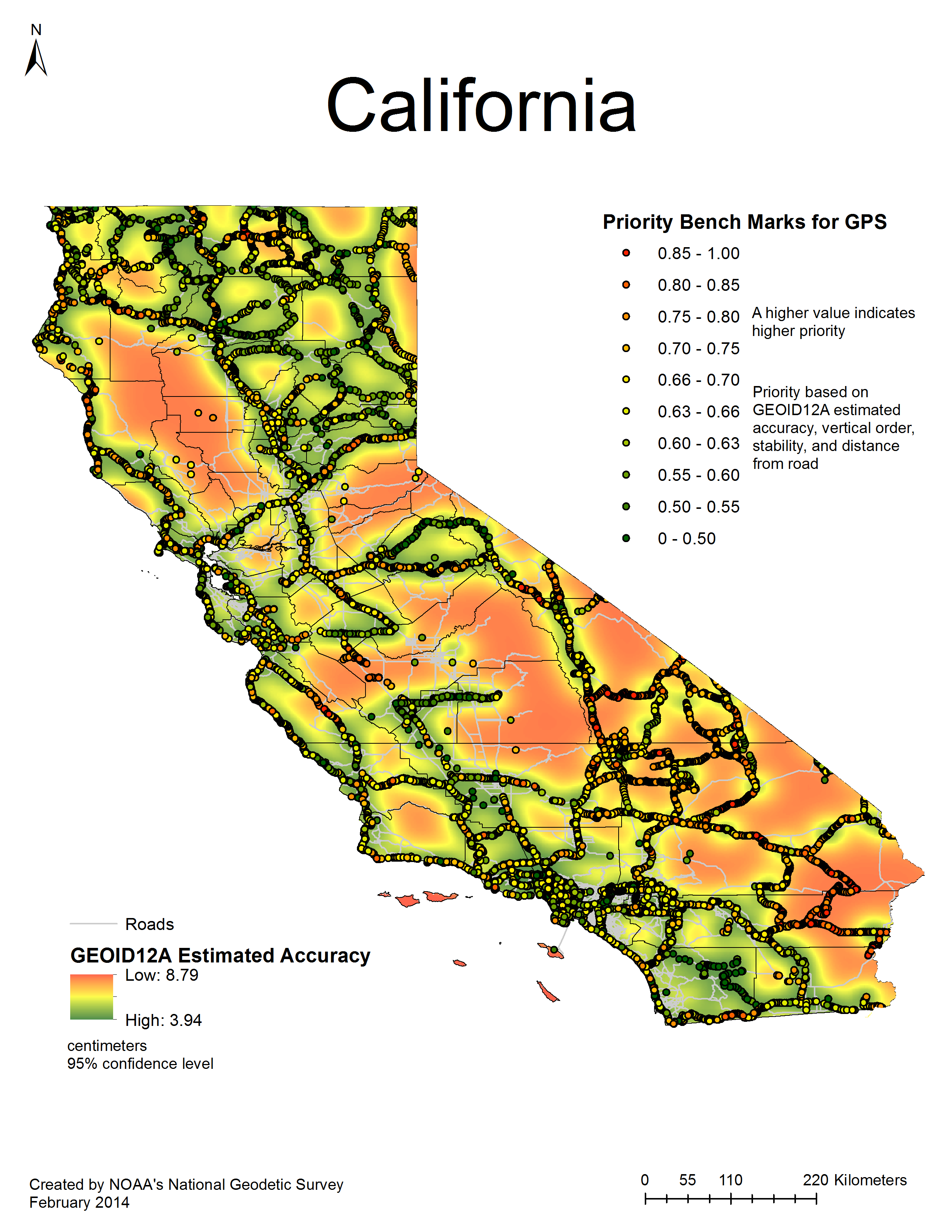
Edit: I found the list as an Excel spreadsheet.