Can someone direct me to the portion of the LS Act where the orientation of the map is up to the control of the County Surveyor? I'm getting comments about how "this time" I can have the north is heading to the bottom left but "title and map body to read from bottom or right side of sheet when north arrow points away from reader". Just curious since I was under the impression that the review of Record of Surveys was supposed to be focused on the technical correctness, and form, but not styling issues. I now a lot of Caltrans maps, and not just the R/W maps have the north pointing at the reader.........
Maybe I missed something. I would like to know.
Map Orientation
-
Gromatici
- Posts: 335
- Joined: Wed Aug 17, 2005 7:06 am
- Location: Santa Barbara, CA
- Contact:
-
Jim Frame

- Posts: 1602
- Joined: Thu Oct 17, 2002 8:52 pm
- Location: Davis, CA
- Contact:
Re: Map Orientation
The CEAC Guide To The Preparation Of Records Of Survey And Corner Records has the following on its checklist:
This is only a guide and its provisions aren't binding on the filing surveyor except where the guidelines adhere to a statutory requirement, so you can orient your ROS any way you want to. And even the Guide recognizes that there may be situations in which north up-or-left doesn't make sense. I wouldn't hesitate to challenge the CS (or, more likely, a subordinate map checker) on this matter.Map orientation, title and map body to read from bottom or right side of sheet when north arrow points away from reader where practicable.
-
Elias French
- Posts: 135
- Joined: Fri Aug 07, 2009 7:22 am
Re: Map Orientation
Second Mr. Frame’s take.
-
hellsangle

- Posts: 713
- Joined: Tue Mar 06, 2007 8:31 am
- Location: Sonoma, CA
- Contact:
Re: Map Orientation
I "third" Mr. Frame's comments! Avisory.
Another reason: Crazy Phil wants Surveyor to Recorder
Have a good weekend, all . . .
Another reason: Crazy Phil wants Surveyor to Recorder
Have a good weekend, all . . .
-
pls5528
- Posts: 244
- Joined: Sat Jan 27, 2007 5:42 pm
Re: Map Orientation
As I was taught old school drafting in the early 1970's. College Civil and Suvey drafting taught that mapping be oriented with north up to the top of the sheet, and the north arrow would be rotated accordingly. Text would read up on the sheet or oriented square with the left side. It was NEVER allowed to have a map drawn with the north arrow facing toward the bottom of the sheet.
-
DWoolley
- Posts: 1082
- Joined: Tue Aug 01, 2006 3:21 pm
- Location: Orange County
- Contact:
Re: Map Orientation
North arrow points to the top of the page or left - unless you are an architect. Was the map intended as a challenge to conventional mapping wisdom? Some sort of protest? Not sure I understand. Having reviewed a few thousand maps for several agencies for approximately 30 years I can say there has been less than, say, 10 maps submitted with a north arrow pointing towards the bottom of the page and a few more with a north arrow more than 22 1/2 degrees towards the right. Best recollection these maps were submitted by inexperienced quasi-surveyors. These maps were always rejected at first review.
Are goofy north arrows accepted in some jurisdictions?
DWoolley
Are goofy north arrows accepted in some jurisdictions?
DWoolley
-
Jim Frame
- Posts: 1602
- Joined: Thu Oct 17, 2002 8:52 pm
- Location: Davis, CA
- Contact:
Re: Map Orientation
Dave, you must not be used to seeing Caltrans ROW and monumentation maps. North is all over the place on 'em.
And Caltrans Records of Survey, too (see attachment).
And Caltrans Records of Survey, too (see attachment).
You do not have the required permissions to view the files attached to this post.
-
Peter Ehlert

- Posts: 724
- Joined: Sun Oct 26, 2003 2:40 pm
- Location: N31°43', W116°39'
- Contact:
Re: Map Orientation
Think about this: standing in the road, looking at the front of the property...
Draw the map with the road at the bottom, and the property above it. Logical.
That was the custom when I worked in Western Oregon decades ago.
somebody is making a big deal out of nothing.
Draw the map with the road at the bottom, and the property above it. Logical.
That was the custom when I worked in Western Oregon decades ago.
somebody is making a big deal out of nothing.
Peter Ehlert PLS 5116 (retired)
-
DWoolley
- Posts: 1082
- Joined: Tue Aug 01, 2006 3:21 pm
- Location: Orange County
- Contact:
Re: Map Orientation
Jim:
You are correct, I do not see to many Caltrans maps. It is unfortunate to see an organization like Caltrans - an organization with good written standards and manuals - not following the most basic mapping standards.
Again, I don't understand the motivation. Mapping generally begins with determining the scale, orientation and sheet layout.
Sincerely,
DWoolley
You are correct, I do not see to many Caltrans maps. It is unfortunate to see an organization like Caltrans - an organization with good written standards and manuals - not following the most basic mapping standards.
Again, I don't understand the motivation. Mapping generally begins with determining the scale, orientation and sheet layout.
Sincerely,
DWoolley
-
Warren Smith
- Posts: 1009
- Joined: Thu Apr 13, 2006 6:41 am
- Location: Sonora
Re: Map Orientation
CalTrans Right of Way maps will be oriented such that the stationing reads up from left to right. The north arrow will follow that layout.
Warren D. Smith, LS 4842
County Surveyor Emeritus
County Surveyor Emeritus
-
Ian Wilson

- Posts: 1087
- Joined: Sat Aug 03, 2002 6:58 am
- Location: Bay Area
Re: Map Orientation
I was taught to draft by a few solid mentors, the first of which was Mr. Frank Durdan, in Junior High School. There are some specific preferences I have when it comes to producing maps: north at top or left, closed symbols + found, open symbols = set, avoid a legend by labeling everything, explain your procedure and reasons, ya-da, ya-da, ya-da.
I see many maps with north arrows pointing right, upper-right, down... Who cares?
I take after William Proxmire, if I can read it and understand it, I don't care where your north arrow is pointed. The map is a means of communicating with others and across time. If legibility or understand-ability are compromised, you'll get your map back with comments. If I understand what you did (note - I don't have to agree with it) I'll sign your map.
There is a surveyor in Southern California whose maps look..well, less than perfectly drafted. His work is impeccable. Finding one of his maps in my project research always brought good feelings. There is another whose maps look as thought they belong on a wall in a technical museum. Their maps...brought shudders. Looks do not equate to quality.
Funky north arrows...I'd rather see those than two-point tangos...
I see many maps with north arrows pointing right, upper-right, down... Who cares?
I take after William Proxmire, if I can read it and understand it, I don't care where your north arrow is pointed. The map is a means of communicating with others and across time. If legibility or understand-ability are compromised, you'll get your map back with comments. If I understand what you did (note - I don't have to agree with it) I'll sign your map.
There is a surveyor in Southern California whose maps look..well, less than perfectly drafted. His work is impeccable. Finding one of his maps in my project research always brought good feelings. There is another whose maps look as thought they belong on a wall in a technical museum. Their maps...brought shudders. Looks do not equate to quality.
Funky north arrows...I'd rather see those than two-point tangos...
Ian Wilson, P.L.S. (CA / NV / CO)
Alameda County Surveyor
Alameda County Surveyor
-
DWoolley
- Posts: 1082
- Joined: Tue Aug 01, 2006 3:21 pm
- Location: Orange County
- Contact:
Re: Map Orientation
I would agree if it was an either/or choice - however, it is not an either/or choice. Arguably, the sliding standards, away from the time honored fundamentals, is how a two monument tango came into being acceptable in certain California regions. Digging up monuments requires considerably more effort than orientation of a north arrow - it is more convenient to falsely add "searched found nothing" than have a north arrow to the top or left, interrelated? I hope not. I want to believe it was simply poor planning by an inexperienced mapper and the licensee didn't want the inconvenience of redrafting the map.Ian Wilson wrote: ...Funky north arrows...I'd rather see those than two-point tangos...
I can (barely) see a map with the north arrow at 90° to the right on a long linear alignment project on a landscape sheet, but never more than 90° right. After 25 years of mapping I may have one of these 90° right in my closet of dirty laundry. Bottom left north arrow? No way, especially not on the record until the end of time.
I may be a mapping dinosaur. Again, what is the motivation behind breaking a basic mapping tenent?
As for the County Surveyor's authority, I believe the authority is granted under "technically correct", similar to spelling. The PLSA doesn't say the County Surveyor has the authority to correct spelling. Are we at the junction to which we argue phonetic spelling is arguable and acceptable? Is a north arrow orientation a style point? Yes, if correct spelling is a style point.
Abbreviations and acronyms, another personal annoyance, indicates we may be working our way to that end. For example, I see "S.S.M." which, I believe, means standard surveying monument. Standard? Which standard? How does that comport with PLSA 8764 (a)?
A lack of standards, coupled with a failure to follow existing standards, is a path to deregulation.
DWoolley
-
hellsangle
- Posts: 713
- Joined: Tue Mar 06, 2007 8:31 am
- Location: Sonoma, CA
- Contact:
Re: Map Orientation
If north isn't up . . . or ninety-degrees to the left . . . or ??? . . . or ??? is it time for some Alprazolam?
Maybe some can't "left-brain" it as well as others and require rigid direction? Sheeeeesh!
Crazy Phil - SURVEYOR to RECORDER!
Maybe some can't "left-brain" it as well as others and require rigid direction? Sheeeeesh!
Crazy Phil - SURVEYOR to RECORDER!
-
Scott
- Posts: 263
- Joined: Mon Oct 11, 2004 11:52 am
- Location: Modesto, CA
Re: Map Orientation
I'm with Ian.
In Hawaii, the ocean is at the bottom of the sheet and the mountain is the top, regardless of North.
My 1st choice is always North up & 2nd choice is North left, but I do have some maps out there with North right or down, purposely, because it made sense for those particular projects, whether because of matching Architect Plans, or Civil Stationing, or retracing a Caltrans map, or some other logical reason.
In Hawaii, the ocean is at the bottom of the sheet and the mountain is the top, regardless of North.
My 1st choice is always North up & 2nd choice is North left, but I do have some maps out there with North right or down, purposely, because it made sense for those particular projects, whether because of matching Architect Plans, or Civil Stationing, or retracing a Caltrans map, or some other logical reason.
Scott DeLaMare
LS 8078
LS 8078
-
mpallamary
- Posts: 3469
- Joined: Tue Mar 11, 2008 2:12 pm
Re: Map Orientation
I always make every effort to set everything due north if possible, even if it means extra sheets.
Some perspective.
https://www.portlandoregon.gov/bes/article/696942
- NSPS/ALTA
D. Presentation
i. The plat or map shall be drawn on a sheet of not less than 8 ½ by 11 inches in size at a legible, standard engineering scale, with that scale
clearly indicated in words or numbers and with a graphic scale. When recordation or filing of a plat or map is required by law, such plat or map shall
be produced in recordable form. The boundary of the surveyed property drawn in a manner that distinguishes it from other lines on the plat or map.
A north arrow (with north to the top of the drawing when practicable),
Always remember the audience.
Some perspective.
https://www.portlandoregon.gov/bes/article/696942
- NSPS/ALTA
D. Presentation
i. The plat or map shall be drawn on a sheet of not less than 8 ½ by 11 inches in size at a legible, standard engineering scale, with that scale
clearly indicated in words or numbers and with a graphic scale. When recordation or filing of a plat or map is required by law, such plat or map shall
be produced in recordable form. The boundary of the surveyed property drawn in a manner that distinguishes it from other lines on the plat or map.
A north arrow (with north to the top of the drawing when practicable),
Always remember the audience.
-
btaylor
- Posts: 501
- Joined: Wed Jul 24, 2002 4:33 pm
- Location: Foster City, CA
Re: Map Orientation
This is a Rohrshach test for surveyors with all different interpretations.
My own take is ROS maps I try to have north upwards as best as possible while finding a significant lot line (in cases of multi-angled parcels) and making it parallel/perpendicular to the sheet. When it comes to the topo for the architect, some want street at the bottom regardless and it doesn't bother me.
Making maps due north can be visually off-putting totally if all the lots are oriented 30-60 degrees off north, so I don't value a true north orientation at all.
I prefer maps have north going up on the map but doesn't really matter once I draft the needed linework out of them. I think it bugs me most when the original subdivision map has north going downward. Then future retracing maps will generally be oriented very differently from the original.
My own take is ROS maps I try to have north upwards as best as possible while finding a significant lot line (in cases of multi-angled parcels) and making it parallel/perpendicular to the sheet. When it comes to the topo for the architect, some want street at the bottom regardless and it doesn't bother me.
Making maps due north can be visually off-putting totally if all the lots are oriented 30-60 degrees off north, so I don't value a true north orientation at all.
I prefer maps have north going up on the map but doesn't really matter once I draft the needed linework out of them. I think it bugs me most when the original subdivision map has north going downward. Then future retracing maps will generally be oriented very differently from the original.
-
DWoolley
- Posts: 1082
- Joined: Tue Aug 01, 2006 3:21 pm
- Location: Orange County
- Contact:
Re: Map Orientation
Land surveyors were required to licensed in California in 1891. At the time, California had only been a state for 41 years. According to contemporary testimony the need for licensure was due to inconsistent mapping standards i.e. specifically scale and mapping quality. The testimony and a written report, circa 1889, from an academic (I recall he was from Pennsylvania) restating the issues with the inconsistent mapping and skillsets in the development of towns throughout the state would become more problematic as time went on. Based on the history, is it is fair to state that without technical standards there is no longer a need for licensure? Ok, fair enough. It would be interesting to see how that would work out for some of the surveyors. Walmart only has so many greeter positions available.
Imagining the world without mapping standards...I beleave ain't no County Surveyor gonna be tellin' me how too cipher and a spellin. I'm too busy too be a bothered by no standards. This includin readin', writing's and...ah,...ah, readin. Spelling, north arrow placement and a grammer are for the highfalutin folks that think there to good for us surveyors. Yes, I am imagining.
Should the licensing body deregulate the profession so former licensees can compete with every contractor, layperson with a GPS unit and engineer licensed in the state? Alternatively, can the community embrace uniform practice standards, embrace regulations as the salvation of the profession and create practices that are easily distinguished from lay work, architects and others?
As my 4th grade teacher, Grace Childs, told us many times "good spelling is important". The contrary can be...well, maybe not in this instance.
DWoolley
Imagining the world without mapping standards...I beleave ain't no County Surveyor gonna be tellin' me how too cipher and a spellin. I'm too busy too be a bothered by no standards. This includin readin', writing's and...ah,...ah, readin. Spelling, north arrow placement and a grammer are for the highfalutin folks that think there to good for us surveyors. Yes, I am imagining.
Should the licensing body deregulate the profession so former licensees can compete with every contractor, layperson with a GPS unit and engineer licensed in the state? Alternatively, can the community embrace uniform practice standards, embrace regulations as the salvation of the profession and create practices that are easily distinguished from lay work, architects and others?
As my 4th grade teacher, Grace Childs, told us many times "good spelling is important". The contrary can be...well, maybe not in this instance.
DWoolley
-
Jim Frame
- Posts: 1602
- Joined: Thu Oct 17, 2002 8:52 pm
- Location: Davis, CA
- Contact:
Re: Map Orientation
Around here the cost of an additional ROS sheet is $773.80, so north goes wherever it has to go to keep the sheet count down.I always make every effort to set everything due north if possible, even if it means extra sheets.
-
William Magee
- Posts: 311
- Joined: Thu Nov 13, 2014 12:27 pm
Re: Map Orientation
Lions, Tigers and Bears, Oh My!
We’re gonna be deregulated when north points down, Oh My!
The sky is falling! The sky is falling!
It is wearing having to tell clients of the need to cough up $$$$$ to pay for a review of which they and I literally never receive comments of value from, and far more often than not, only receive red lines reflecting some overly bloated self important personal preferences.
We’re gonna be deregulated when north points down, Oh My!
The sky is falling! The sky is falling!
It is wearing having to tell clients of the need to cough up $$$$$ to pay for a review of which they and I literally never receive comments of value from, and far more often than not, only receive red lines reflecting some overly bloated self important personal preferences.
Please don’t sue.
-
Peter Ehlert
- Posts: 724
- Joined: Sun Oct 26, 2003 2:40 pm
- Location: N31°43', W116°39'
- Contact:
Re: Map Orientation
North, declination +11°03"
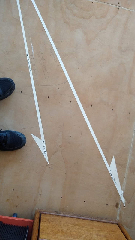
or
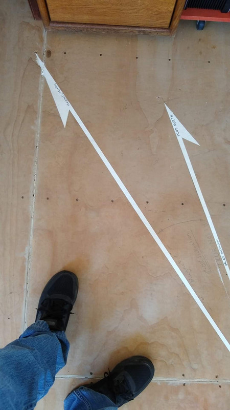

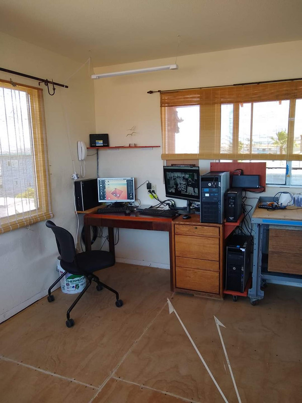
Surveyor to Recorder, just do it
or
Surveyor to Recorder, just do it
Peter Ehlert PLS 5116 (retired)
-
Mr. Smith

- Posts: 225
- Joined: Fri Oct 04, 2013 6:44 am
- Location: Montague CA
- Contact:
Re: Map Orientation
A different frame of reference is a difficult concept for some. Railroad mapping has stationing running in a direction and the mapping follows along and the north arrow spins around and around in mountainous terrain.
Easement line = long dash
Boundary line = solid and heavy
Adjoiners = solid light
Right of Way line (options here) = can be solid or long and two short, can be heavy or light.
Set back line = short dash
Leader line = very short dashes, light
Dimensioning line = to have small arrows, dark
Water = Long and three short
Shown so you can criticize me, it is Just a few of the way I do it, by the way I was raised with line thickness and darkness meaning something. Lately I have heard some recorders wanting all the same line weight. I also map so reduced copies will be fine using larger fonts etc.
This is a fun topic
Easement line = long dash
Boundary line = solid and heavy
Adjoiners = solid light
Right of Way line (options here) = can be solid or long and two short, can be heavy or light.
Set back line = short dash
Leader line = very short dashes, light
Dimensioning line = to have small arrows, dark
Water = Long and three short
Shown so you can criticize me, it is Just a few of the way I do it, by the way I was raised with line thickness and darkness meaning something. Lately I have heard some recorders wanting all the same line weight. I also map so reduced copies will be fine using larger fonts etc.
This is a fun topic
-
Jim Frame
- Posts: 1602
- Joined: Thu Oct 17, 2002 8:52 pm
- Location: Davis, CA
- Contact:
Re: Map Orientation
Every ROS I submit in my home county comes back with the notation "The use of shadow fonts is discouraged because the recorder’s office may or may not reject your map because of shadow font, reason is that they do not reproduce well." So far the Recorder hasn't rejected any of my maps, in spite of the shadow font.Lately I have heard some recorders wanting all the same line weight.
I like using a shadow font for context information. Below is a partial screenshot of the Recorder's own digital file, and I don't see any problem with the reproduction.
You do not have the required permissions to view the files attached to this post.
-
mpallamary
- Posts: 3469
- Joined: Tue Mar 11, 2008 2:12 pm
Re: Map Orientation
Jim Frame, you're point is well taken! Cost is a factor for sure! Years ago, when we used to be able to file a 20 page corner record I thought it was great as the extra pages allowed me to get as much information out there as I could. I am filing an 18 page Record of Survey this week and cost aside, I convinced my client that it would make things easier for everyone. I have an eight page ROS under review at the same time.
It would be nice if there was a better way to review and manage things. It would be nice of CLSA could put together some statewide standards or something. As an example, here in San Diego, the city has a mapping manual and the county has its own, different one.
Again, your point is exceptionally well taken. Perhaps as we move into a digital environment, none of this will matter!
It would be nice if there was a better way to review and manage things. It would be nice of CLSA could put together some statewide standards or something. As an example, here in San Diego, the city has a mapping manual and the county has its own, different one.
Again, your point is exceptionally well taken. Perhaps as we move into a digital environment, none of this will matter!
-
Gromatici
- Posts: 335
- Joined: Wed Aug 17, 2005 7:06 am
- Location: Santa Barbara, CA
- Contact:
Re: Map Orientation
Well said Mr. Wilson!
I get to decide how to orient the map that makes the most sense. If it's good enough for Caltrans, it's good enough for me!
Anyone who thinks this is some sort of indication of sub-standard work is misguided. Standards can't be held up in higher regard above all else. They are useful, and good, but there is always an exception. Disparaging fellow surveyors for having north pointing at the reader surely is worse than having a north arrow pointing a the reader. This has revealed more than just drafting opinions.
Thanks for the input. I'm glad to hear that people are free to use their minds still.
I get to decide how to orient the map that makes the most sense. If it's good enough for Caltrans, it's good enough for me!
Anyone who thinks this is some sort of indication of sub-standard work is misguided. Standards can't be held up in higher regard above all else. They are useful, and good, but there is always an exception. Disparaging fellow surveyors for having north pointing at the reader surely is worse than having a north arrow pointing a the reader. This has revealed more than just drafting opinions.
Thanks for the input. I'm glad to hear that people are free to use their minds still.
Eric J Ackerman, PLS, RPLS, CFedS
Licenses: CA. AZ, ID, NV, CO,UT
Gromatici Land Surveying, Inc.
http://www.gromatici.com
proposals@gromatici.com
Licenses: CA. AZ, ID, NV, CO,UT
Gromatici Land Surveying, Inc.
http://www.gromatici.com
proposals@gromatici.com
-
bruce hall
- Posts: 646
- Joined: Sun Oct 05, 2003 9:18 pm
- Location: huntington beach, orange county, california
Re: Map Orientation
north should be up or to the left, or real close.